The seeds of Canada’s transition to clean energy were planted 150 years ago
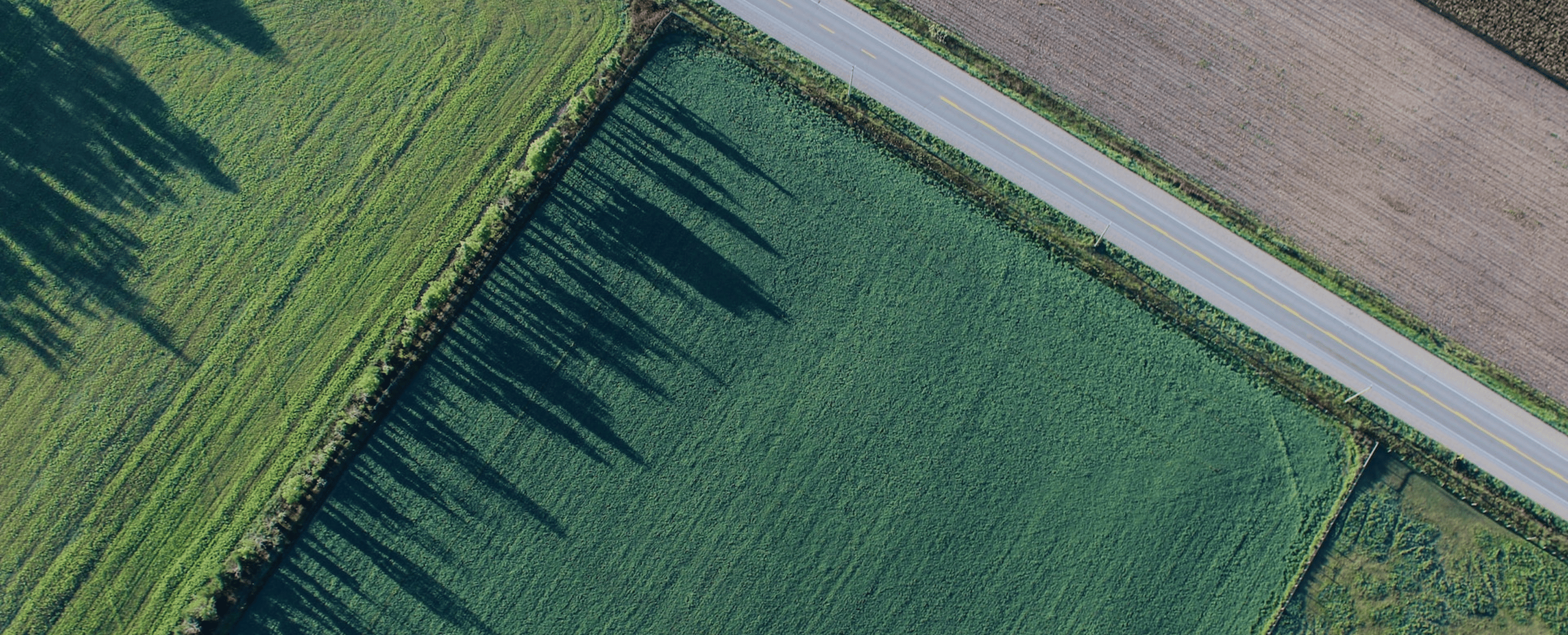
Last December myself and a few colleagues travelled to my hometown in Alberta. As we were flying into Western Canada watching the familiar checkerboard landscape spread out underneath us, my Finnish colleagues suddenly wondered how my home country came to look like that – what is the story behind the perfect squares covering all Western […]
Last December myself and a few colleagues travelled to my hometown in Alberta. As we were flying into Western Canada watching the familiar checkerboard landscape spread out underneath us, my Finnish colleagues suddenly wondered how my home country came to look like that – what is the story behind the perfect squares covering all Western Canada?
As Canada was still forming, Prime Minister John A. MacDonald’s government set out to economize the prairies and put the ‘Canadian’ stakes into the proverbial ground to ward off impending American land grabs. The project scope was to measure, section, assign land use and document the work. This massive task was assigned to Dominion Land Survey (DLS) company and commenced in 1871.
The original scope of work covered only Manitoba but eventually led to the same mapping in Saskatchewan, Alberta and British Columbia – spanning a total land mass of nearly 3,000,000,000km2. To this date, DLS is the world’s largest survey grid laid down in a single integrated system. The work they did was not only paramount to the settlement of the prairies, but also a big reason why we are not the 51st state.
To this day DLS measurements hold true in the form of nearly perfect squares
Taking the lessons learned in Europe, DLS decided to take a consistent approach and use the lines of meridian as the framework for all sectioning. Keep in mind, at that time the only truly accurate meridian was the prime meridian in Europe. This meant that all other meridians were established using pretty much only the sun and stars.
The ‘first’ meridian was the boundary for where the western provinces began. From here the DLS team began to map out the land using traditional survey chains, which measured approximately 20m in length. And so the team went 20m at a time, land parcel by land parcel. The entire process was cumbersome, time consuming, and backbreaking work. To this day, barring a few centimeters here and there, the DLS measurements hold true. The exacting nature of their work is nothing short of a marvel.
Nearly 150 years later these flat, square and accessible land parcels mean that we can produce more clean energy with lower costs.
The checkerboard structures make for the perfect framework for ground mount solar projects
The physical result of DLS’s work is nearly perfect squares covering Western Canada. These squares also included planning for infrastructure (national railway), public needs (schools and counsels), as well as protecting pristine natural landscapes and habitats. This is why, when flying into Western Canada, you will see a checkerboard landscape with towns and lakes nestled in between.
Nearly 150 years later these checkerboard structures make for the perfect framework for large scale ground mount solar projects. In Alberta where land is predominantly flat, these sections, 640 acres (or quarters 120 acres) allow solar developers to capitalize on their design benefits. Flat, square and accessible land parcels mean that we can produce more clean energy with lower costs. Alberta also boasts some of Canada’s highest irradiation yields. Combining all factors, we are well poised to lead the transition to clean energy in Canada.
Last fall Korkia announced a partnership with Universal Kraft to develop solar energy in Canada, resulting in one of Korkia’s flagship investments. Read more: We are expanding to Canada – Project in Alberta will generate solar energy for up to 100,000 households
Kristina Sweet, is an Investment Director at Korkia. She is from Ponoka, Alberta, but living in Helsinki, Finland.